|
|
Persian Nastaliq -
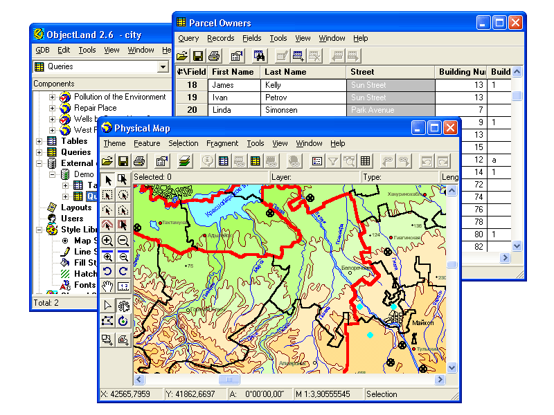 | GIS ObjectLand is a universal Geographic Information System for Windows. Key features: - creation of vector-raster maps with arbitrary structure of layers and feature types; - creation of themes. Theme is a user presentation of a map; - control of displaying features depending on the chosen scale; -...
|
 | GIS ObjectLand is a universal Geographic Information System for Windows. Key features: - creation of vector-raster maps with arbitrary structure of layers and feature types in an internal ObjectLand database or in following DBMSs - MS SQL Server, Oracle, DB2, MySQL, Interbase/Firebird, PostgreSQL, M...
|
| EarthBrowser is an innovative earth simulation that combines an easy to navigate 3 dimensional globe with real-time weather conditions and 7 day forecasts for thousands of locations. Live earthquakes, webcams, volcanoes and current cloud formations are also featured. A screen saver option lets it ta...
|
OkMap (in Applications)
 | OkMap is a free software for many outdoor activities: - Search and rescue - Trekking - Off road - Boating - Flying - Mountain bike - Geocaching - Hunting and fishing - Finding mushrooms - Soft air OkMap help you to: - Calibrate raster maps with different types of projections - Create own digital map...
|
 | In many fields (eg. Civil Engeneering (USCS, DIN 4023, ...), Architecture, Geosciences, Cartography, ...) complex hatch patterns are needed for a clear graphical representation. AHatch Pro is a flexible tool for the design of AutoCAD hatch patterns. The generated hatch patterns can be used with the ...
|
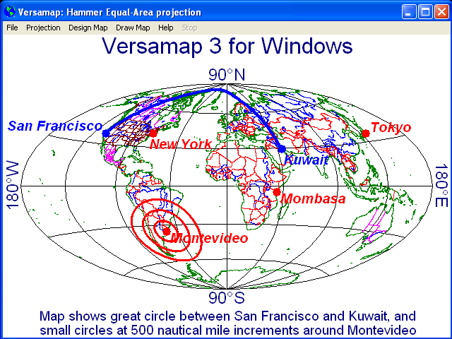 | Versamap draws outline maps on 16 map projections. The program allows users to print publication quality maps; and to export maps in vector graphic (WMF, CGM, DXF, ASCII) and bitmapped (BMP) formats. Versamap is supplied with digital maps from the Versamap Micro World Database, a world map with 220,...
|
|
|