|
|
Order by Related
- New Release
- Rate
Results in Title For geo data german streets
 | For the area of the Federal Republic of Germany more than 2,7 million street coordinates with a coverage of 100% are available. The geo data offered here are in high-precision quality and are present in different coordinate and reference systems. Street coordinates or also called street section coordinates are meaning the summary of several postal house addresses to an averaged position on street or street section basis. The street coordinates are to be used with applications, which are developed to assign street oriented address groups exact positions. Street-exact geo data are on the one hand less expensive than the high resolution house-exact geo data, on the other hand they are more exact than the economically priced administrative geo data. The possible field of application is very various. E.g. own address lists can be enriched with geo references and visualized on suitable map material. The application scope reaches from information systems over navigation services, geo marketing, telecommunications and UTMS based services up to Web applications and tasks of the power authorities and security services. Another point of interest can be the establishing relationships between data derived from different hierarchies and levels. For example, it could be desirable to know to which federal state, administrative district and city a building belongs to. The coordinates of the streets are present as geographic coordinates, UTM coordinates and Gauss-Krueger coordinates. Geographical coordinates in degree notation are particularly suitable well for searches with Google Earth. Here is as an example an Internet URL with coordinates from the "Geo Data German Streets", which can represent the location of Killet Software Ing.-GbR: "http://maps.google.com/maps?t=k&ll=51.397363,6.450883&spn=0.002,0.002". The first value behind the identifier "ll" (lat / lon) is the geographical latitude, then the geographical longitude follows. .. |
|
 | For many countries street coordinates are present with coverage degrees upto 100 percent. The geo data offered here are in high-precision quality and are present in different coordinate and reference systems. Street coordinates or also called street section coordinates are meaning the summary of several postal house addresses to an averaged position on street or street section basis. The street coordinates are to be used with applications, which are developed to assign street oriented address groups exact positions. The possible field of application is very various. So e.g. own address lists can be enriched with geo references and visualized on suitable map material. The application scope reaches from information systems over navigation services, geo marketing, telecommunications and UTMS based services up to Web applications and tasks of the power authorities and security services. Another point of interest can be the establishing relationships between data derived from different hierarchies and levels. For example, it could be desirable to know to which administrative or postal unit a street belongs to. The coordinates of the streets are present as geographic coordinates and UTM coordinates. Geographical coordinates in degree notation are particularly suitable well for searches with Google Earth. Here is as an example an Internet URL with coordinates from the "Geo Data International Streets", which can represent the location of Killet Software Ing.-GbR: "http://maps.google.com/maps?t=k&ll=51.397363,6.450883&spn=0.002,0.002". The first value behind the identifier "ll" (lat / lon) is the geographical latitude, then the geographical longitude follows. The shown URL can be inserted directly into the address field of the browser to represent a map cutout on the screen. Street-exact geo data are on the one hand less expensive than the high resolution house-exact geo data, on the other hand they are more exact than the economically priced administrative geo data. ..
|
|
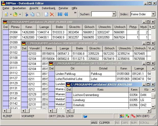 | Geodata of the Federal Republic Germany with municipalities, postal codes, telefone preselections. Suitable for branch searches, periphery searches and distance computations. Georeferences as Gauss Krueger, UTM and Geographic Coordinates and also Ground Level Elevations. ORTREF: 12.500 geocoded cities and municipalities. ORTGEM: Allocation of 12.500 cities and municipalities to the localities. ORTTLREF: 63.000 geocoded local parts. ORTTLGEM: Allocation of 63.000 local parts to the localities. PLZREF: 32.000 geocoded postal zip codes of the zip areas and p.o. box areas. PLZGEM: Allocation of 32.000 postal zip codes to the localities. VORWREF: 20,500 geocoded telephone local area preselections. VORWGEM: Allocation of 20.500 telephone local area preselections to the localities. KREIS: 450 Local districts. REGBEZ: Governmental districts. LAND: Counties of the German Federal Republic. The download contains a test composition of the data of 5 local districts and the exact data description. A freeware conversion program CONVERT for producing of different data formats can be downloaded from the site http://www.killetsoft.de/p_cona_e.htm. Here the data fields of the table ORTREF are specified as example: Place name, municipality key, geographical longitude and geographical latitude in degree notation, geographical longitude and geographical latitude in degree / minute / secund notation, Gauss Krueger easting, Gauss Krueger northing, UTM easting, UTM northing, elevation over sea level, new postal zip code (significant digits), old postal zip code, number of inhabitants, No. of the telephone directory, No. of the topographic card 1:25000, UNLOCODE, type of place, date of record change. .. |
|
 | For the area of the Federal Republic of Germany more than 2,7 million street coordinates with a coverage of 100% are available. The geo data offered here are in high-precision quality and are present in different coordinate and reference systems. Street coordinates or also called street section coordinates are meaning the summary of several postal house addresses to an averaged position on street or street section basis. The streetd coordinates are to be used with applications, which are developed to assign street oriented address groups exact positions. Street-exact geo data are on the one hand less expensive than the high resolution house-exact geo data, on the other hand they are more exact than the economically priced administrative geo data. The possible field of application is very various. E.g. own address lists can be enriched with geo references and visualized on suitable map material. The application scope reaches from information systems over navigation services, geo marketing, telecommunications and UTMS based services up to Web applications and tasks of the power authorities and security services. Another point of interest can be the establishing relationships between data derived from different hierarchies and levels. For example, it could be desirable to know to which federal state, administrative district and city a building belongs to. The coordinates of the streets are present as geographic coordinates, UTM coordinates and Gauss-Krueger coordinates. Geographical coordinates in degree notation are particularly suitable well for searches with Google Earth. Here is as an example an Internet URL with coordinates from the "Geo Data German Streets", which can represent the location of Killet Software Ing.-GbR: "http://maps.google.com/maps?t=k&ll=51.397363,6.450883&spn=0.002,0.002". The first value behind the identifier "ll" (lat / lon) is the geographical latitude, then the geographical longitude follows. ..
|
|
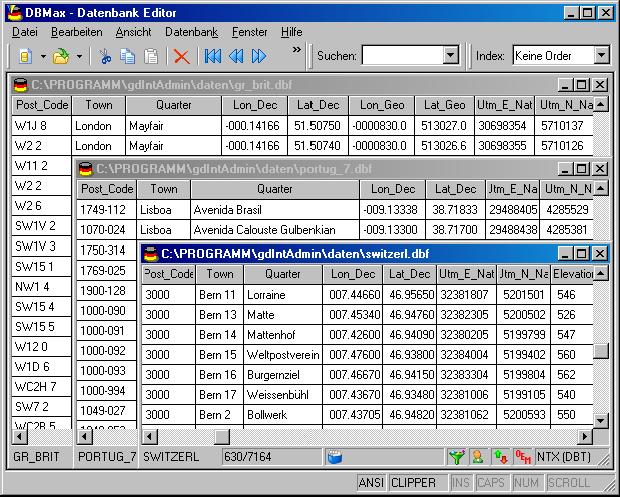 | Geodata of the European and International countries with municipalities and postal codes. Georeferences as UTM- and geographic coordinates (WGS84, ETRS89). Suitable for branch searches, periphery searches and distance computations. These countries are available: Albania, Andorra, Belgium, Bosnia, Bulgaria, Denmark, Canada, Estonia, Finland, France, Georgia, Gibraltar, Greece, Great Britain, Ireland, Italy, Ex Yugoslavia, Canada, Croatia, Latvia, Liechtenstein, Lithuania, Luxembourg, Malta, Macedonia, Mexico, Moldavia, Monaco, Netherlands, Norway, Austria, Poland, Portugal, Romania, Russia, San Marino, Sweden, Switzerland, Slovakia, Slovenia, Spain, Czech Republic, Turkey, Ukraine, Hungary, Vatican, White Russia, USA, Cyprus and many more. The download contains a test composition of data cutouts of a lot of countries in different file formates and the exact data description. Here the available data fields of the tables are specified: National identification of the country, local identification for the place within the country, postal zip code, place name, local part name, local administrative identification (municipality key), geographical longitude and geographical latitude in degree and deg/min/sec notation, UTM easting and UTM northing on the natural and an uniformal meridian strip, local size (categories), local meaning (categories), 4 hierarchical administrative units, which are superordinate the place. .. |
|
 | For many countries street coordinates are present with coverage degrees upto 100 percent. The geo data offered here are in high-precision quality and are present in different coordinate and reference systems. Street coordinates or also called street section coordinates are meaning the summary of several postal house addresses to an averaged position on street or street section basis. The street coordinates are to be used with applications, which are developed to assign street oriented address groups exact positions. The possible field of application is very various. So e.g. own address lists can be enriched with geo references and visualized on suitable map material. The application scope reaches from information systems over navigation services, geo marketing, telecommunications and UTMS based services up to Web applications and tasks of the power authorities and security services. Another point of interest can be the establishing relationships between data derived from different hierarchies and levels. For example, it could be desirable to know to which administrative or postal unit a street belongs to. The coordinates of the streets are present as geographic coordinates and UTM coordinates. Geographical coordinates in degree notation are particularly suitable well for searches with Google Earth. Here is as an example an Internet URL with coordinates from the "Geo Data International Streets", which can represent the location of Killet Software Ing.-GbR: "http://maps.google.com/maps?t=k&ll=51.397363,6.450883&spn=0.002,0.002". The first value behind the identifier "ll" (lat / lon) is the geographical latitude, then the geographical longitude follows. The shown URL can be inserted directly into the address field of the browser to represent a map cutout on the screen. Street-exact geo data are on the one hand less expensive than the high resolution house-exact geo data, on the other hand they are more exact than the economically priced administrative geo data. ..
|
|
 | Microsoft Streets & Trips makes trip planning easy. .. |
|
 | Dictionary German-Dutch-German (over 600,000 entries). Thesaurus German (280,000 entries) and Thesaurus Dutch (180,000 entries). Conjugation German (950,000 conjugated forms) and Conjugation Dutch (600,000 conjugated forms). .. |
|
 | Geo World is a handy application for finding out detailed information about any country in the world. .. |
|
| RCounter Geo is a system for gathering and reviewing statistics, analysis of web-site attendance (as well as separate web-pages).
RCounter is an easy-to-implement professional web site tracking and analysis service. .. |
|
Results in Keywords For geo data german streets
| For the area of the Federal Republic of Germany more than 2,7 million street coordinates with a coverage of 100% are available. The geo data offered here are in high-precision quality and are present in different coordinate and reference systems. Street coordinates or also called street section coordinates are meaning the summary of several postal house addresses to an averaged position on street or street section basis. The street coordinates are to be used with applications, which are developed to assign street oriented address groups exact positions. Street-exact geo data are on the one hand less expensive than the high resolution house-exact geo data, on the other hand they are more exact than the economically priced administrative geo data. The possible field of application is very various. E.g. own address lists can be enriched with geo references and visualized on suitable map material. The application scope reaches from information systems over navigation services, geo marketing, telecommunications and UTMS based services up to Web applications and tasks of the power authorities and security services. Another point of interest can be the establishing relationships between data derived from different hierarchies and levels. For example, it could be desirable to know to which federal state, administrative district and city a building belongs to. The coordinates of the streets are present as geographic coordinates, UTM coordinates and Gauss-Krueger coordinates. Geographical coordinates in degree notation are particularly suitable well for searches with Google Earth. Here is as an example an Internet URL with coordinates from the "Geo Data German Streets", which can represent the location of Killet Software Ing.-GbR: "http://maps.google.com/maps?t=k&ll=51.397363,6.450883&spn=0.002,0.002". The first value behind the identifier "ll" (lat / lon) is the geographical latitude, then the geographical longitude follows... |
|
| For the area of the Federal Republic of Germany more than 2,7 million street coordinates with a coverage of 100% are available. The geo data offered here are in high-precision quality and are present in different coordinate and reference systems. Street coordinates or also called street section coordinates are meaning the summary of several postal house addresses to an averaged position on street or street section basis. The streetd coordinates are to be used with applications, which are developed to assign street oriented address groups exact positions. Street-exact geo data are on the one hand less expensive than the high resolution house-exact geo data, on the other hand they are more exact than the economically priced administrative geo data. The possible field of application is very various. E.g. own address lists can be enriched with geo references and visualized on suitable map material. The application scope reaches from information systems over navigation services, geo marketing, telecommunications and UTMS based services up to Web applications and tasks of the power authorities and security services. Another point of interest can be the establishing relationships between data derived from different hierarchies and levels. For example, it could be desirable to know to which federal state, administrative district and city a building belongs to. The coordinates of the streets are present as geographic coordinates, UTM coordinates and Gauss-Krueger coordinates. Geographical coordinates in degree notation are particularly suitable well for searches with Google Earth. Here is as an example an Internet URL with coordinates from the "Geo Data German Streets", which can represent the location of Killet Software Ing.-GbR: "http://maps.google.com/maps?t=k&ll=51.397363,6.450883&spn=0.002,0.002". The first value behind the identifier "ll" (lat / lon) is the geographical latitude, then the geographical longitude follows...
|
|
 | DB3NF is a Rapid Web Application Development platform (RAD) designed for fast and easy creation of high performance, maintainable and scalable Web applications of virtually any kind. It also dramatically reduces development and QA time and provides a consistent look and feel throughout the application.
DB3NF consists of six main parts ordered as they appear in the development process:
DB3NF Administration console. It allows creating and maintaining application schema and business rules. It also provides application administration and deployment.
"Schema" database. Schema database structure is fixed and the data is manipulated by the Administration Console. It defines and stores application structure, business rules and basic presentation rules. This database contains a set of deployment stored procedures. They read data from the Schema database and automatically create in the target ("Data") database a third normal form table structure with all necessary tables, primary, check and foreign key constraints, indexes and stored procedures.
"Data" database. This database is created automatically and its structure depends on the application schema.
Stored procedures are created automatically by the "Schema" database procedures. No development work is required to create and modify them when application schema changes. DB3NF component "talks" to the "Data" database exclusively through these optimized stored procedures, which provides for high performance of the DB3NF platform.
DB3NF component. The component is completely generic and integrates seamlessly with both databases. No design work is required after application schema is created and deployed. DB3NF automatically "learns" application schema and rules when application starts. The component employs various caching techniques and is extremely fast and efficient.
The ASP code in DB3NF is very simple and straightforward. It is easy to write and maintain... |
|
| Microsoft Streets & Trips makes trip planning easy...
|
|
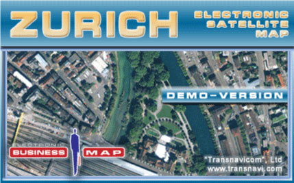 | Demo-version of Satellite Map of Zurich! The newest developments and progressive experience of Transnavi.com give a chance to create such high-quality and unique products! Satellite technologies are available to everybody!.. |
|
| For many countries street coordinates are present with coverage degrees upto 100 percent. The geo data offered here are in high-precision quality and are present in different coordinate and reference systems. Street coordinates or also called street section coordinates are meaning the summary of several postal house addresses to an averaged position on street or street section basis. The street coordinates are to be used with applications, which are developed to assign street oriented address groups exact positions. The possible field of application is very various. So e.g. own address lists can be enriched with geo references and visualized on suitable map material. The application scope reaches from information systems over navigation services, geo marketing, telecommunications and UTMS based services up to Web applications and tasks of the power authorities and security services. Another point of interest can be the establishing relationships between data derived from different hierarchies and levels. For example, it could be desirable to know to which administrative or postal unit a street belongs to. The coordinates of the streets are present as geographic coordinates and UTM coordinates. Geographical coordinates in degree notation are particularly suitable well for searches with Google Earth. Here is as an example an Internet URL with coordinates from the "Geo Data International Streets", which can represent the location of Killet Software Ing.-GbR: "http://maps.google.com/maps?t=k&ll=51.397363,6.450883&spn=0.002,0.002". The first value behind the identifier "ll" (lat / lon) is the geographical latitude, then the geographical longitude follows. The shown URL can be inserted directly into the address field of the browser to represent a map cutout on the screen. Street-exact geo data are on the one hand less expensive than the high resolution house-exact geo data, on the other hand they are more exact than the economically priced administrative geo data...
|
|
| For many countries street coordinates are present with coverage degrees upto 100 percent. The geo data offered here are in high-precision quality and are present in different coordinate and reference systems. Street coordinates or also called street section coordinates are meaning the summary of several postal house addresses to an averaged position on street or street section basis. The street coordinates are to be used with applications, which are developed to assign street oriented address groups exact positions. The possible field of application is very various. So e.g. own address lists can be enriched with geo references and visualized on suitable map material. The application scope reaches from information systems over navigation services, geo marketing, telecommunications and UTMS based services up to Web applications and tasks of the power authorities and security services. Another point of interest can be the establishing relationships between data derived from different hierarchies and levels. For example, it could be desirable to know to which administrative or postal unit a street belongs to. The coordinates of the streets are present as geographic coordinates and UTM coordinates. Geographical coordinates in degree notation are particularly suitable well for searches with Google Earth. Here is as an example an Internet URL with coordinates from the "Geo Data International Streets", which can represent the location of Killet Software Ing.-GbR: "http://maps.google.com/maps?t=k&ll=51.397363,6.450883&spn=0.002,0.002". The first value behind the identifier "ll" (lat / lon) is the geographical latitude, then the geographical longitude follows. The shown URL can be inserted directly into the address field of the browser to represent a map cutout on the screen. Street-exact geo data are on the one hand less expensive than the high resolution house-exact geo data, on the other hand they are more exact than the economically priced administrative geo data... |
|
| Allows bilingual or multilingual computer users quick and easy access to the accented letters and characters that are unique to the German language but not displayed on English keyboards. Generate text and symbols from the German alphabet including the Eurodollar symbol in any Windows?based program including e-mail and chat rooms. Can be operated without the mouse with intuitive shortcut keys. Users have the ability to also build, store and insert phrases in German. .. |
|
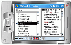
 | An Englich to German and German to English Dictionary with 29000 word entries. You can enter a word and you get a list of possible translations. If you only enter the beginnig of a word you get a list of all matching words and there translations... |
|
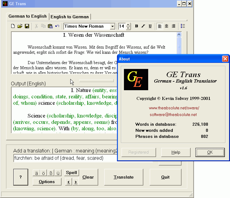 | This program specializes in translating German texts into English, but can also help in translating individual English words into German. With a translation database exceeding 220,000 German words and phrases... |
|
Results in Description For geo data german streets
 | For the area of the Federal Republic of Germany more than 19 million house coordinates with a coverage of 100% are available. The geo data offered here are in high-precision quality and are present in different coordinate and reference systems. House Coordinates or also called Geo Coded Building Addresses are meaning the connection between the postal addresses of buildings and their accurate positions. The house coordinates are the basis for applications, which are developed to assign buildings exact positions. The possible field of application is very various. So e.g. own address lists can be enriched with geo references and visualized on suitable map material. The application scope reaches from information systems over navigation services, geo marketing, telecommunications and UTMS based services up to Web applications and tasks of the power authorities and security services. Another point of interest can be the establishing relationships between data derived from different hierarchies and levels. For example, it could be desirable to know to which federal state, administrative district and city a building belongs to. The coordinates of the buildings are present as geographic coordinates, UTM coordinates and Gauss Kruger coordinates. Geographical coordinates in degree notation are particularly suitable well for searches with Google Earth. Here is as an example an Internet URL with coordinates from the "Geo Data German Houses", which can represent the location of Killet Software Ing.-GbR point-exactly: "http://maps.google.com/maps?t=k&ll=51.397363,6.450883&spn=0.002,0.002". The first value behind the identifier "ll" (lat / lon) is the geographical latitude, then the geographical longitude follows. The shown URL can be inserted directly into the address field of the browser to represent a map cutout on the screen... |
|
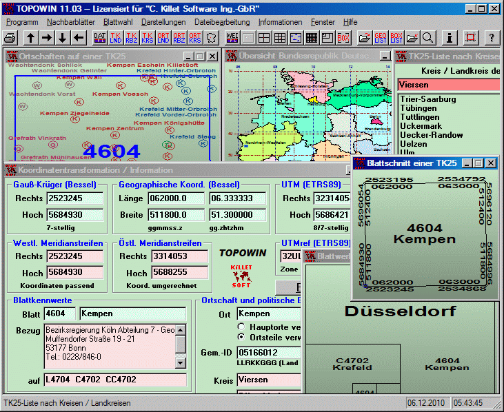 | TOPOWIN is a state-wide register of the German topographic cartographies and of localities with geo references in different coordinate systems. It also is a topographic information system...
|
|
| Today, businesses are going online. Effective web marketing starts with thorough analysis of your potential customers browsing habits, web site effectiveness monitoring and geo-targeting.
Web server raw logs offer a lot of valuable marketing information. The only question is: what tool do we use to extract this precious data from meaningless lines of alphanumerical characters, which are actually web server logs. The right tool makes the difference between a lame e-business development strategy and a winning one!
Introducing Geo Log Analyzer by Altstone Software, the unique web server logs analyzer capable of representing geographical stats on your website visitors in self-explanatory graphical world map view!
Geo Log Analyzer is a specialized net-marketer.. |
|
| The mean streets run rife with organized criminals, mobsters, ninjas and zombies. Nowhere is safe for the ordinary folk. Nobody dares tackle this problem head on, until a pair of unwitting heroes take up the challenge.
Awoken from the dead, these ex-wise guys possess the cunning, reflexes and wit required to clean up the streets for good.
They are the Dead Mobsters!..
|
|
 | For many countries house coordinates are present with coverage degrees upto 100 percent. The geo data offered here are in high-precision quality and are present in different coordinate and reference systems. House Coordinates or also called Geo Coded Building Addresses are meaning the connection between the postal addresses of buildings and their accurate positions. The house coordinates are the basis for applications, which are developed to assign buildings exact positions. The possible field of application is very various. So e.g. own address lists can be enriched with geo references and visualized on suitable map material. The application scope reaches from information systems over navigation services, geo marketing, telecommunications and UTMS based services up to Web applications and tasks of the power authorities and security services. Another point of interest can be the establishing relationships between data derived from different hierarchies and levels. For example, it could be desirable to know to which administrative or postal unit a building belongs to. The coordinates of the buildings are present as geographic coordinates and UTM coordinates. Geographical coordinates in degree notation are particularly suitable well for searches with Google Earth. Here is as an example an Internet URL with coordinates from the "Geo Data International Houses", which can represent the location of Killet Software Ing.-GbR point-exactly: "http://maps.google.com/maps?t=k&ll=51.397363,6.450883&spn=0.002,0.002". The first value behind the identifier "ll" (lat / lon) is the geographical latitude, then the geographical longitude follows. The shown URL can be inserted directly into the address field of the browser to represent a map cutout on the screen... |
|
 | For many countries house coordinates are present with coverage degrees upto 100 percent. The geo data offered here are in high-precision quality and are present in different coordinate and reference systems. House Coordinates or also called Geo Coded Building Addresses are meaning the connection between the postal addresses of buildings and their accurate positions. The house coordinates are the basis for applications, which are developed to assign buildings exact positions. The possible field of application is very various. So e.g. own address lists can be enriched with geo references and visualized on suitable map material. The application scope reaches from information systems over navigation services, geo marketing, telecommunications and UTMS based services up to Web applications and tasks of the power authorities and security services. Another point of interest can be the establishing relationships between data derived from different hierarchies and levels. For example, it could be desirable to know to which administrative or postal unit a building belongs to. The coordinates of the buildings are present as geographic coordinates and UTM coordinates. Geographical coordinates in degree notation are particularly suitable well for searches with Google Earth. Here is as an example an Internet URL with coordinates from the "Geo Data International Houses", which can represent the location of Killet Software Ing.-GbR point-exactly: "http://maps.google.com/maps?t=k&ll=51.397363,6.450883&spn=0.002,0.002". The first value behind the identifier "ll" (lat / lon) is the geographical latitude, then the geographical longitude follows. The shown URL can be inserted directly into the address field of the browser to represent a map cutout on the screen...
|
|
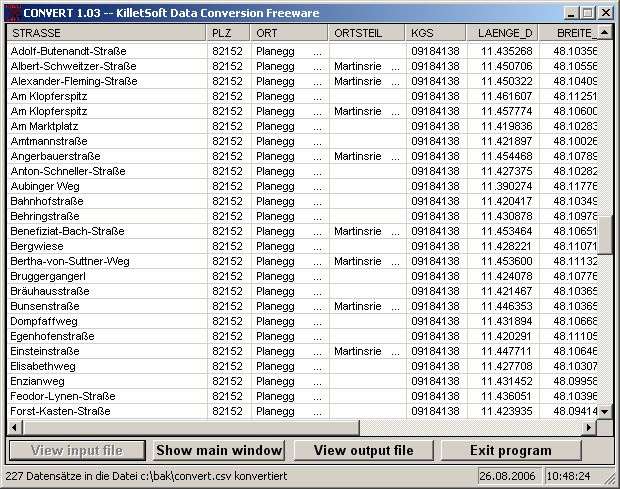
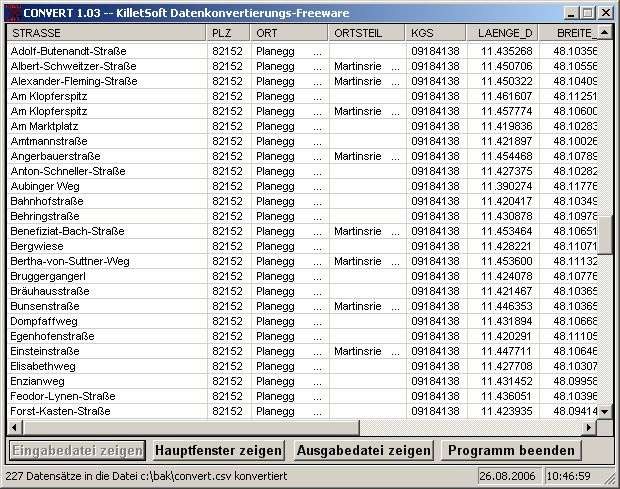
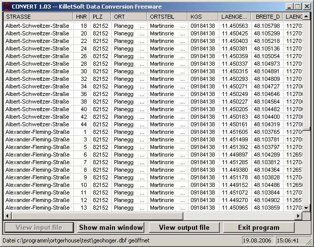
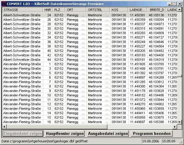
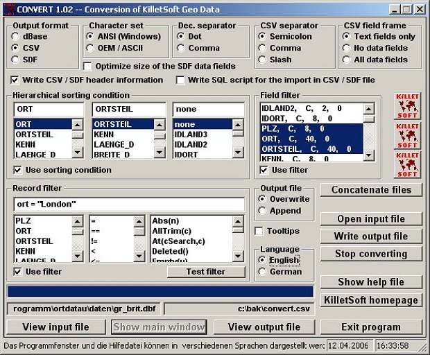 | The freeware program CONVERT converts any dBase formatted data base tables and special the Geo Data supplied by KilletSoft GbR as dBase tables into different data formats. Thus the import of the data in any data base management system or file system will be possible. With the program for example you can convert dBase data into the SDF format (Simple Document Format) or into the CSV format (Comma Separated Value). For the import in MySQL or SQL data bases the necessary "CREATE TABLE" script can be generated. Further the selection of the data on data fields and data records is possible. In addition the data can be sorted on base of the data fields. Data from several files can be joined to a common file. A help file contains global information to the program in form of an program intern electronic manual. The Englisch or German language help can be called with the "Help" button while the program is running. Normally you must select only the data format you need. The usually common parameters are already preset. Proceed as follows: 1. If necessarily join several dbase files to a new single dbase file. 2. Open the new single dBase file or an other dBase file with "Open input file" 3. Select all characteristics and data selections, which are needed for your data format. 4. Write the converted data with "Write output file" into a file. The program is in most cases self-describing. When running over with the mouse pointer you receive continuous assistance in yellow supported Tooltip fields... |
|
 | Enter the streets after midnight to take on the toughest urban dragsters. It's about the car; it's about the speed; but most of all it's about the respect. Rocket through the city to rule the night streets. Make your car rock with custom paint engine enhancements ground effects and sound systems. Fatten your wallet with every win and pump the cash back into your ride. Out-maneuver the cops that are determined to end your race from behind the wheel of 10 super-charged dragsters. Radical new camera angles change the way you race including the mini-hood fender wheel and wing cams... |
|
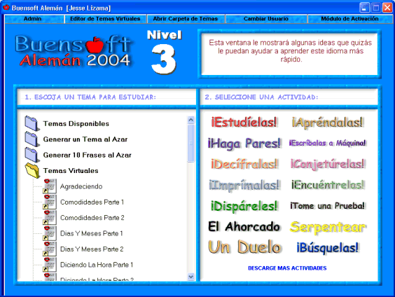 | BuenSoft German let's you play 14 listening-interactive games designed to give Spanish-speakers of all ages a fast and easy way to have fun and improve their German. BuenSoft German is not based on the same format as many others German Software programs with fixed content, instead BuenSoft German was created as a conversational utility where users can add to the program only the phrases they want to learn. Many Subjects are now available for download buensoft.com and many more are being added weekly. Every German Subject is supported by high-quality audio and recorded with native speaker voices. Find out how easy it is to learn German with Buensoft Now!.. |
|
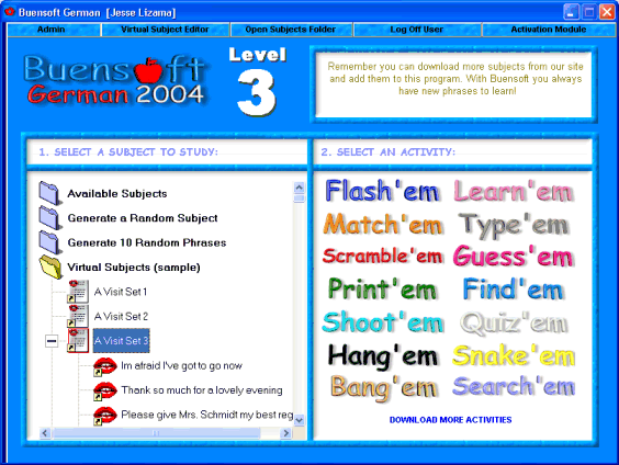 | BuenSoft German let's you play 14 listening-interactive games designed to give learners of all ages a fast and easy way to have fun and learn German. BuenSoft German is not based on the same format as many others German Software programs with fixed content, instead BuenSoft German was created as a conversational utility where users can add to the program only the phrases they want to learn. Download this FREE program now... |
|
Results in Tags For geo data german streets
| For the area of the Federal Republic of Germany more than 2,7 million street coordinates with a coverage of 100% are available. The geo data offered here are in high-precision quality and are present in different coordinate and reference systems. Street coordinates or also called street section coordinates are meaning the summary of several postal house addresses to an averaged position on street or street section basis. The streetd coordinates are to be used with applications, which are developed to assign street oriented address groups exact positions. Street-exact geo data are on the one hand less expensive than the high resolution house-exact geo data, on the other hand they are more exact than the economically priced administrative geo data. The possible field of application is very various. E.g. own address lists can be enriched with geo references and visualized on suitable map material. The application scope reaches from information systems over navigation services, geo marketing, telecommunications and UTMS based services up to Web applications and tasks of the power authorities and security services. Another point of interest can be the establishing relationships between data derived from different hierarchies and levels. For example, it could be desirable to know to which federal state, administrative district and city a building belongs to. The coordinates of the streets are present as geographic coordinates, UTM coordinates and Gauss-Krueger coordinates. Geographical coordinates in degree notation are particularly suitable well for searches with Google Earth. Here is as an example an Internet URL with coordinates from the "Geo Data German Streets", which can represent the location of Killet Software Ing.-GbR: "http://maps.google.com/maps?t=k&ll=51.397363,6.450883&spn=0.002,0.002". The first value behind the identifier "ll" (lat / lon) is the geographical latitude, then the geographical longitude follows... |
|
| For the area of the Federal Republic of Germany more than 2,7 million street coordinates with a coverage of 100% are available. The geo data offered here are in high-precision quality and are present in different coordinate and reference systems. Street coordinates or also called street section coordinates are meaning the summary of several postal house addresses to an averaged position on street or street section basis. The street coordinates are to be used with applications, which are developed to assign street oriented address groups exact positions. Street-exact geo data are on the one hand less expensive than the high resolution house-exact geo data, on the other hand they are more exact than the economically priced administrative geo data. The possible field of application is very various. E.g. own address lists can be enriched with geo references and visualized on suitable map material. The application scope reaches from information systems over navigation services, geo marketing, telecommunications and UTMS based services up to Web applications and tasks of the power authorities and security services. Another point of interest can be the establishing relationships between data derived from different hierarchies and levels. For example, it could be desirable to know to which federal state, administrative district and city a building belongs to. The coordinates of the streets are present as geographic coordinates, UTM coordinates and Gauss-Krueger coordinates. Geographical coordinates in degree notation are particularly suitable well for searches with Google Earth. Here is as an example an Internet URL with coordinates from the "Geo Data German Streets", which can represent the location of Killet Software Ing.-GbR: "http://maps.google.com/maps?t=k&ll=51.397363,6.450883&spn=0.002,0.002". The first value behind the identifier "ll" (lat / lon) is the geographical latitude, then the geographical longitude follows...
|
|
| For many countries street coordinates are present with coverage degrees upto 100 percent. The geo data offered here are in high-precision quality and are present in different coordinate and reference systems. Street coordinates or also called street section coordinates are meaning the summary of several postal house addresses to an averaged position on street or street section basis. The street coordinates are to be used with applications, which are developed to assign street oriented address groups exact positions. The possible field of application is very various. So e.g. own address lists can be enriched with geo references and visualized on suitable map material. The application scope reaches from information systems over navigation services, geo marketing, telecommunications and UTMS based services up to Web applications and tasks of the power authorities and security services. Another point of interest can be the establishing relationships between data derived from different hierarchies and levels. For example, it could be desirable to know to which administrative or postal unit a street belongs to. The coordinates of the streets are present as geographic coordinates and UTM coordinates. Geographical coordinates in degree notation are particularly suitable well for searches with Google Earth. Here is as an example an Internet URL with coordinates from the "Geo Data International Streets", which can represent the location of Killet Software Ing.-GbR: "http://maps.google.com/maps?t=k&ll=51.397363,6.450883&spn=0.002,0.002". The first value behind the identifier "ll" (lat / lon) is the geographical latitude, then the geographical longitude follows. The shown URL can be inserted directly into the address field of the browser to represent a map cutout on the screen. Street-exact geo data are on the one hand less expensive than the high resolution house-exact geo data, on the other hand they are more exact than the economically priced administrative geo data... |
|
| For many countries street coordinates are present with coverage degrees upto 100 percent. The geo data offered here are in high-precision quality and are present in different coordinate and reference systems. Street coordinates or also called street section coordinates are meaning the summary of several postal house addresses to an averaged position on street or street section basis. The street coordinates are to be used with applications, which are developed to assign street oriented address groups exact positions. The possible field of application is very various. So e.g. own address lists can be enriched with geo references and visualized on suitable map material. The application scope reaches from information systems over navigation services, geo marketing, telecommunications and UTMS based services up to Web applications and tasks of the power authorities and security services. Another point of interest can be the establishing relationships between data derived from different hierarchies and levels. For example, it could be desirable to know to which administrative or postal unit a street belongs to. The coordinates of the streets are present as geographic coordinates and UTM coordinates. Geographical coordinates in degree notation are particularly suitable well for searches with Google Earth. Here is as an example an Internet URL with coordinates from the "Geo Data International Streets", which can represent the location of Killet Software Ing.-GbR: "http://maps.google.com/maps?t=k&ll=51.397363,6.450883&spn=0.002,0.002". The first value behind the identifier "ll" (lat / lon) is the geographical latitude, then the geographical longitude follows. The shown URL can be inserted directly into the address field of the browser to represent a map cutout on the screen. Street-exact geo data are on the one hand less expensive than the high resolution house-exact geo data, on the other hand they are more exact than the economically priced administrative geo data...
|
|
| Geodata of the Federal Republic Germany with municipalities, postal codes, telefone preselections. Suitable for branch searches, periphery searches and distance computations. Georeferences as Gauss Krueger, UTM and Geographic Coordinates and also Ground Level Elevations. ORTREF: 12.500 geocoded cities and municipalities. ORTGEM: Allocation of 12.500 cities and municipalities to the localities. ORTTLREF: 63.000 geocoded local parts. ORTTLGEM: Allocation of 63.000 local parts to the localities. PLZREF: 32.000 geocoded postal zip codes of the zip areas and p.o. box areas. PLZGEM: Allocation of 32.000 postal zip codes to the localities. VORWREF: 20,500 geocoded telephone local area preselections. VORWGEM: Allocation of 20.500 telephone local area preselections to the localities. KREIS: 450 Local districts. REGBEZ: Governmental districts. LAND: Counties of the German Federal Republic. The download contains a test composition of the data of 5 local districts and the exact data description. A freeware conversion program CONVERT for producing of different data formats can be downloaded from the site http://www.killetsoft.de/p_cona_e.htm. Here the data fields of the table ORTREF are specified as example: Place name, municipality key, geographical longitude and geographical latitude in degree notation, geographical longitude and geographical latitude in degree / minute / secund notation, Gauss Krueger easting, Gauss Krueger northing, UTM easting, UTM northing, elevation over sea level, new postal zip code (significant digits), old postal zip code, number of inhabitants, No. of the telephone directory, No. of the topographic card 1:25000, UNLOCODE, type of place, date of record change... |
|
| World GeoDatabase - Latitude, Longitude, Altitude For Entire World. Create the GeoDatabase for the entire world. This program create the geographical location Latitude, Longitude, and Altitude (Elevation) for every city, village, region, state..
|
|
| Geodata of the European and International countries with municipalities and postal codes. Georeferences as UTM- and geographic coordinates (WGS84, ETRS89). Suitable for branch searches, periphery searches and distance computations. These countries are available: Albania, Andorra, Belgium, Bosnia, Bulgaria, Denmark, Canada, Estonia, Finland, France, Georgia, Gibraltar, Greece, Great Britain, Ireland, Italy, Ex Yugoslavia, Canada, Croatia, Latvia, Liechtenstein, Lithuania, Luxembourg, Malta, Macedonia, Mexico, Moldavia, Monaco, Netherlands, Norway, Austria, Poland, Portugal, Romania, Russia, San Marino, Sweden, Switzerland, Slovakia, Slovenia, Spain, Czech Republic, Turkey, Ukraine, Hungary, Vatican, White Russia, USA, Cyprus and many more. The download contains a test composition of data cutouts of a lot of countries in different file formates and the exact data description. Here the available data fields of the tables are specified: National identification of the country, local identification for the place within the country, postal zip code, place name, local part name, local administrative identification (municipality key), geographical longitude and geographical latitude in degree and deg/min/sec notation, UTM easting and UTM northing on the natural and an uniformal meridian strip, local size (categories), local meaning (categories), 4 hierarchical administrative units, which are superordinate the place... |
|
 | The database contain geodata of the Federal Republic of Germany with geo referenced towns, municipalities, town quarters, administrative units, postal codes, telephone preselections, nature areas, landscapes, climatic zones for proximity searches ec... |
|
 | The database contain geodata of the Federal Republic of Germany with geo referenced towns, municipalities, town quarters, administrative units, postal codes, telephone preselections, nature areas, landscapes, climatic zones for proximity searches ec... |
|
| Microsoft Streets & Trips makes trip planning easy... |
|
Related search : eo datastreet coordinatesdata german,geo data germangerman streets englishdata german streetsgeo datacoordinates aredata internationalstreet coordinates,geo data internationalinternational streets englishdata international streetsgeo datacoordinates Order by Related
- New Release
- Rate
streets of rage 3 -
streets of rage -
pocket streets -
streets and trips -
streets and trips 2008 -
|
|